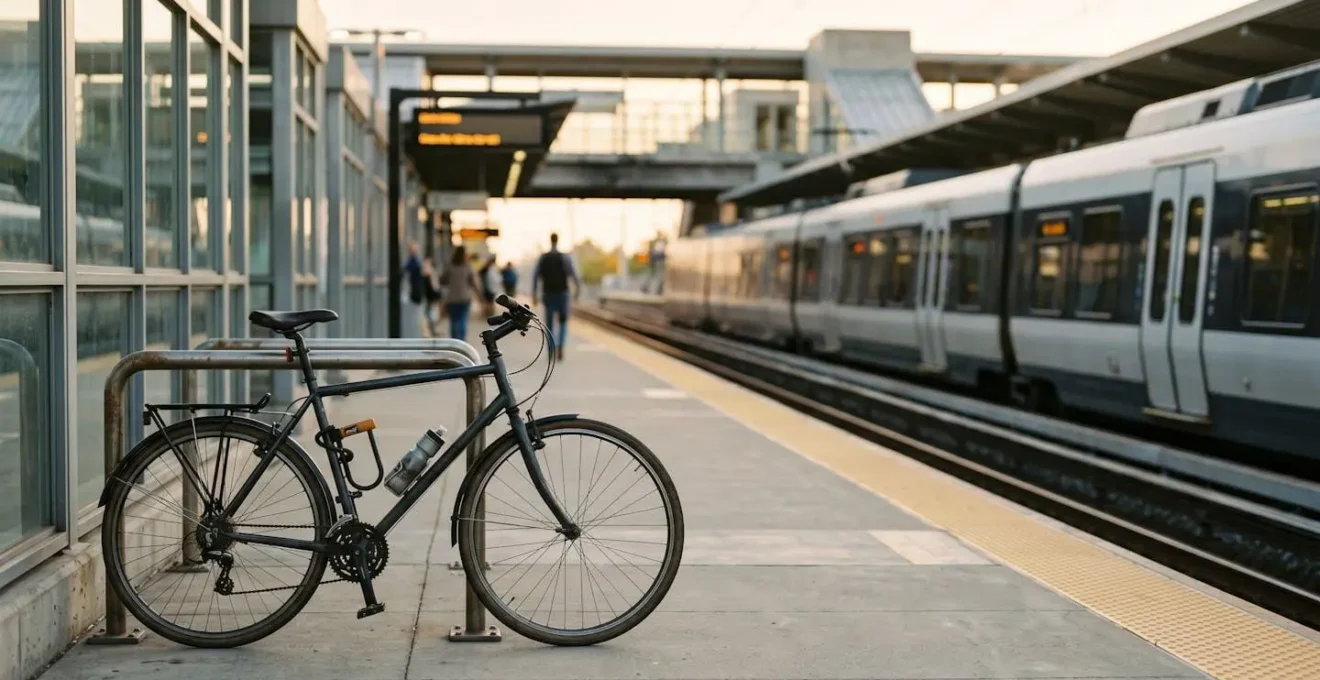
True commuting efficiency isn’t about finding the single “best” route; it’s about mastering a dynamic system of transport modes that you can adapt in real-time.
- Combining a partial car or bike journey with public transport consistently outperforms end-to-end driving for longer commutes in terms of both time and cost.
- A strategic “notification stack” using multiple apps is essential for identifying disruptions and activating backup plans before they cause major delays.
Recommendation: Stop thinking of your commute as a static A-to-B line. Start designing it as a flexible network with built-in decision triggers to switch modes and always stay ahead of delays.
Is your daily commute a source of constant frustration? You leave on time, follow the same trusted route, yet a single traffic jam or train delay can throw your entire schedule into chaos. Many commuters try to solve this by leaving earlier, trying a different road, or simply accepting defeat. We’ve been told the solution lies in finding that one perfect, unbeatable route. This common wisdom, however, is the very source of the problem.
The conventional approach treats a commute as a single, fragile line. A more resilient and far more efficient method is to view your journey as a dynamic system. This is the core of multimodal commuting: the strategic combination of private vehicles (car, bike) and public transit (train, bus) within a single trip. It’s not just about using different transport options; it’s about making them work together in a flexible, intelligent network that you control. This isn’t about simply swapping your car for a train; it’s about using your car to get to the *right* train, faster.
But what if the key to a faster, cheaper, and less stressful commute wasn’t finding a magic route, but mastering the art of the intelligent pivot? This guide will change how you think about your travel. We will not give you a list of generic tips. Instead, we’ll provide a strategic framework for becoming a true multimodal planner. We will explore the data-backed reasons why partial journeys beat end-to-end trips, how to build a real-time intelligence system with apps you already have, and crucially, how to know precisely when to abandon your primary plan and switch modes to save time. Get ready to take control of your commute.
This article provides a complete framework for mastering your daily travel. Below, the table of contents outlines the key strategies we’ll cover, from planning your initial route to making agile, in-the-moment decisions that keep you moving.
Summary: The Multimodal Commute: A Strategic Guide to a Faster Journey
- Why Driving to a Train Station Beats End-to-End Car Journeys for Commutes Over 20 Miles
- How to Plan Multimodal Routes Using Real-Time Disruption Alerts in 4 Apps
- Cycling to Stations vs Driving: Which Saves More Time and Money for 3-Mile Distances?
- The Timetable Mistake That Breaks Multimodal Connections and Adds 30 Minutes
- When to Abandon Your Planned Route: The 3 Real-Time Signals to Switch Modes
- Why Park-and-Ride Beats Driving Into City Centres for Time and Cost
- Why Hub Stations Are Navigation Anchors in Complex Metro Systems Like London or Paris
- How Urban Mobility Integration Cuts Commute Costs by 50% in UK Cities
Why Driving to a Train Station Beats End-to-End Car Journeys for Commutes Over 20 Miles
The default solution for a long commute is often seen as the car, offering door-to-door convenience. However, for any journey over 20 miles, this logic quickly breaks down. The single-mode car journey is highly susceptible to a single point of failure: traffic congestion. A significant portion of these longer commutes involves navigating unpredictable, slow-moving traffic as you approach urban centres. By adopting a multimodal approach—driving to a train station and completing the journey on public transport—you surgically remove the most volatile and time-consuming part of the trip. You trade the stress of city-centre driving for the predictable, and often faster, speed of a train.
This strategy, often called “first-leg driving,” allows you to use your car for what it’s best at: covering medium distances in low-density areas. Once you reach the perimeter of high congestion, you switch to a mode of transport designed for high-capacity, high-speed urban travel. This isn’t just theory; it’s a growing trend. The logic is simple: a 10-minute traffic jam on a motorway is an annoyance, but a 10-minute jam in a city centre can easily spiral into 30 minutes of gridlock. Multimodal travel is about creating connection resilience and ensuring that no single bottleneck can derail your entire journey.
The data underscores this shift. While the average commute time in Great Britain was 28 minutes in 2024, this figure hides the extreme delays faced by long-distance car commuters. By strategically parking at a suburban station, you are effectively creating a defensive buffer against the worst of urban congestion. You are no longer at the mercy of unpredictable road conditions for the most critical part of your commute, allowing for a more predictable arrival time and a significant reduction in travel-related stress.
How to Plan Multimodal Routes Using Real-Time Disruption Alerts in 4 Apps
A successful multimodal strategy isn’t about a single, perfect plan; it’s about having a system that provides real-time intelligence and pre-planned alternatives. Your smartphone is your command centre, but relying on just one app is a critical mistake. A robust system requires a “notification stack,” where different apps serve specific functions, from high-level planning to granular, mode-specific alerts. This layered approach ensures you receive the right information at the right time, allowing you to make proactive decisions instead of reacting to delays after they’ve happened.
Think of it as building an early-warning system for your commute. Your primary app (like Google Maps or Citymapper) gives you the overall journey-as-a-system view. It plans the initial route and monitors general traffic and transit conditions. However, the real power comes from the secondary and tertiary layers. A dedicated app for your specific train or bus operator provides much deeper, more timely alerts about cancellations or platform changes on the most critical leg of your journey. These apps often push notifications minutes before they are reflected in generalist planners.
The final layers are your safety net. Having a ride-sharing app ready with a saved payment method means you can execute a “mode-switch” to a car service in seconds if a major disruption occurs. Following local transport authorities on social media often provides human intelligence that precedes any official app update, such as reports of station overcrowding or unforeseen incidents. This multi-layered approach gives you the flexibility premium—the ability to pivot smoothly and maintain control, no matter what the network throws at you.
Your Action Plan: Building a Commuter’s Notification Stack
- Primary Planner: Use a comprehensive route planner like Citymapper or Google Maps for initial end-to-end journey planning and broad real-time updates across all modes.
- Mode-Specific Alerts: Install the dedicated app for your critical transit leg (e.g., the national rail operator’s app or the local bus authority’s app) and enable advanced delay notifications for your specific line.
- Immediate Backup: Pre-load a ride-sharing app (like Uber or Lyft) with your payment method saved, enabling one-tap activation during a major service disruption.
- Human Intelligence Layer: Follow your local transport authority’s and key operator’s official social media feeds (especially on platforms like X/Twitter) for real-time, on-the-ground reports that often surface before app notifications.
Cycling to Stations vs Driving: Which Saves More Time and Money for 3-Mile Distances?
For the “last mile” or, more accurately, the “first few miles” to the station, the choice between cycling and driving seems like a simple trade-off. The car offers comfort from the elements, while the bike offers exercise. However, when you analyze distances of around three miles, the bicycle often emerges as the clear winner on both time and cost, especially during peak hours. The perceived speed of a car over such a short distance is an illusion, eroded by the “hidden time costs” of driving.
Consider the full sequence of a 3-mile drive to a station: finding car keys, navigating residential streets, potentially hitting traffic at junctions, searching for a parking space, walking from the car to the platform, and paying for that parking. For a bicycle, the sequence is simpler: unlock, ride (often using more direct paths or cycle lanes unavailable to cars), lock the bike at a station rack (usually closer to the platform than car parks), and walk to the platform. In many urban and suburban environments, this streamlined process makes cycling consistently faster for short-hop connections.
The financial argument is even more compelling. The costs of car ownership—fuel, insurance, maintenance, and depreciation—are magnified when used for short, inefficient trips. Add daily or monthly station parking fees, and the cost quickly escalates. A bicycle’s running costs are negligible in comparison. While the initial investment in a quality bike and lock is a factor, it’s a one-time expense that is rapidly offset by the savings. Furthermore, there are significant, if less direct, benefits; research has found that even short-distance cycle commuters show 31% higher peak aerobic power compared to their car-driving counterparts, turning commute time into productive health investment.
The decision ultimately hinges on infrastructure. The availability of secure bike parking at the station and safe cycling routes are critical factors. However, where this infrastructure exists, the strategic choice for the first/last three miles is overwhelmingly in favour of two wheels over four, offering a faster, cheaper, and healthier start to the multimodal journey.
The Timetable Mistake That Breaks Multimodal Connections and Adds 30 Minutes
The most common failure point in a multimodal commute isn’t a dramatic train cancellation; it’s a subtle miscalculation in connection times. The critical mistake is focusing only on the official departure and arrival times of the main transit leg (the train or express bus) while underestimating the “buffer time” needed for the connections at either end. This is known as ignoring the transfer penalty. Planners often budget for the best-case scenario—a swift walk from car to platform—and leave no margin for common, predictable frictions.
These frictions include: needing to find a different parking spot than usual, a longer-than-expected queue at the ticket machine, or a last-minute platform change that requires navigating a crowded station. A seemingly safe 5-minute connection buffer can be instantly erased by one of these minor events, leading to a missed train. The consequence isn’t a 5-minute delay; it’s waiting 15, 20, or even 30 minutes for the next service, completely negating any time saved by planning the route. This is particularly relevant given that national travel survey data shows that 60% of multimodal trips in the UK start with walking, a segment highly variable in duration.
A robust multimodal plan builds in a realistic, not optimistic, transfer buffer. A good rule of thumb is to calculate your ideal connection time and then add 50%. If you think you can make the connection in 6 minutes, plan for 9. This may feel counterintuitive to an “efficient traveller,” but this small time investment is a premium paid for connection resilience. It ensures your meticulously planned journey doesn’t collapse due to a single, minor friction point. The goal is not to have the tightest possible connection, but the most reliable one.
Case Study: The Importance of Travel Time Ratio in Shanghai
Research on multimodal public transport in Shanghai provided a critical insight into commuter psychology. The study found that the “travel time ratio” is the single most important factor influencing whether a commuter chooses public transport over a private car. For journeys up to 6 km that are well-served by the metro, the total travel time (including transfers) must be comparable to driving for the public option to be considered competitive. This highlights how a poorly planned transfer, which adds 20-30 minutes to a journey, can completely break the competitive advantage of the entire multimodal system and push commuters back into their cars.
When to Abandon Your Planned Route: The 3 Real-Time Signals to Switch Modes
The most advanced skill of a multimodal planner is not creating the initial plan, but knowing when to discard it. Clinging to a failing route out of stubbornness is the antithesis of efficiency. The key is to pre-define your “decision triggers”—specific, observable, real-time signals that automatically prompt you to switch to a backup plan. Having these triggers mentally locked in removes emotion and hesitation from the decision-making process, enabling a swift and decisive pivot.
There are three primary categories of signals to watch for:
1. The Quantitative Delay Alert: This is the most straightforward trigger. It’s a specific, numerical notification from your app stack. You must pre-define your tolerance. For example: “If my train app shows a delay of more than 15 minutes, I will immediately abandon the train leg and activate my ride-sharing app.” The specific number (10, 15, 20 minutes) depends on your personal schedule and the frequency of the service, but it must be a hard rule, not a vague feeling.
2. The Qualitative Density Signal: This trigger is not based on an app notification but on your own observation. It’s the visual cue of unusual crowd density. If you arrive at a station platform and it is significantly more crowded than usual for that time of day, it’s a strong leading indicator of a major, unannounced disruption. The app might say the train is “On Time,” but a packed platform is telling you a different story—perhaps the previous two services were cancelled. This is a critical signal to trust your eyes over the app and consider your alternative route immediately.
3. The Cascading Failure Alert: This is a more subtle signal. It occurs when you receive a notification for a minor delay on a different line that connects to yours further down the route. While not affecting your immediate leg, it indicates stress on the wider network. This is a “yellow flag” that should heighten your awareness and prime you to be ready for a mode-switch. A problem on a connecting line can quickly cascade into delays and overcrowding on your own, and the savvy planner uses this early warning to get ahead of the problem.
Why Park-and-Ride Beats Driving Into City Centres for Time and Cost
The concept of Park-and-Ride (P&R) is a cornerstone of multimodal strategy, and its logic is brutally simple. It isolates the two most inefficient parts of a car-based city commute—navigating congested downtown streets and finding parking—and replaces them with a faster, cheaper, and more predictable alternative. By parking at a dedicated lot on the city’s periphery and switching to a bus or tram for the final leg, you are strategically outsourcing the most stressful part of your journey to a system designed to handle it.
The time savings are twofold. First, you avoid the gridlock that characterizes most city centres during peak hours. A dedicated bus lane can bypass kilometres of stationary traffic, turning a 30-minute crawl into a 10-minute ride. Second, and just as significant, is the elimination of “parking-cruising time.” The time spent circling blocks, hunting for a space, is a huge and often unmeasured drain. In fact, US Department of Transportation research shows that US drivers waste an average of 17 hours annually cruising for parking, a figure that skyrockets to 107 hours for drivers in New York City. P&R eliminates this entirely; you park in a designated, easy-to-access lot and you’re done.
The cost benefits are just as stark. City centre parking is a premium commodity, with daily rates that can quickly add up to hundreds of dollars or pounds per month. P&R facilities are typically far cheaper, and sometimes even free, with the cost of the onward journey on public transport being significantly less than the price of a downtown parking space. When you factor in the reduced fuel consumption and vehicle wear from not driving in stop-and-go traffic, the savings become substantial. For context, separate American Public Transportation Association research found individuals can save over $13,000 annually on average by switching from driving to public transit—P&R offers a powerful hybrid of this saving.
Why Hub Stations Are Navigation Anchors in Complex Metro Systems Like London or Paris
In the sprawling, often confusing networks of major metropolitan transit systems, hub stations are more than just busy intersections; they are the critical navigation anchors of the entire system. Stations like King’s Cross St Pancras in London or Châtelet–Les Halles in Paris are the logistical hearts that pump commuters through the city. For the multimodal planner, these hubs are not just places to change lines; they are strategic assets that offer a wealth of flexibility and contingency options. Understanding their function is key to mastering a complex urban commute.
The primary value of a hub is the sheer density of choice it offers. A disruption on one line is less of a catastrophe when you are standing in a location from which five other lines, multiple bus routes, and a cycle-hire dock are immediately accessible. This concentration of services creates an environment of extreme mode-switching potential. A problem that would be journey-ending at a small, single-line local station becomes a mere inconvenience at a hub, requiring only a quick walk to a different platform to continue on an alternate route.
Moreover, these hubs are increasingly designed as epicentres for multimodal integration. The best-designed cities actively facilitate the easy flow between different modes at these points. This investment in infrastructure pays dividends, as analysis by urban mobility experts shows up to 3x more multimodal trips in cities that prioritize bicycle-friendly transit integration at their hubs. This trend is only accelerating, confirming the power of a well-designed central point.
Multimodal trips combining cycling with public transit have increased by over 40% in major metropolitan areas since 2020.
– Tamobyke urban mobility research, The Complete Guide to Multimodal E-Bike Commuting
Therefore, a sophisticated commuter doesn’t just pass through hubs; they use them. When planning a route, they will often favour a path that goes via a major hub, even if it’s not the absolute shortest on paper. They are buying an insurance policy—the flexibility premium that comes from knowing you are always just a few steps away from a dozen alternative ways to reach your destination.
Key Takeaways
- True commute efficiency comes from flexibility, not a single rigid plan. View your journey as a dynamic system you can control.
- A “notification stack” of multiple apps is your best defense against disruptions, providing early warnings that allow for proactive mode-switching.
- For shorter distances to a station (e.g., 3 miles), cycling often beats driving in both time and cost due to eliminated parking and traffic friction.
How Urban Mobility Integration Cuts Commute Costs by 50% in UK Cities
The final frontier of multimodal efficiency isn’t just about individual planning; it’s about the system itself becoming smarter. In many UK cities, a quiet revolution in urban mobility integration is fundamentally changing the cost equation for commuters. Through integrated ticketing, fare capping, and standardized payment systems, cities are breaking down the financial barriers between different modes of transport, making a combined bus, train, and even bike journey seamless and surprisingly affordable.
Fare capping is perhaps the most powerful tool in this arsenal. This system ensures that no matter how many journeys you take across different modes in a day or week, you will never pay more than a pre-set maximum amount. This removes the “meter is running” anxiety of taking multiple buses or trains. You can make the most efficient travel choice at any given moment—like hopping on a bus for three stops to bypass a crowded sidewalk—without being penalized financially. The result is a system that actively encourages flexible, spontaneous multimodal travel.
The financial impact can be dramatic. The recent UK government’s bus fare cap initiative has shown savings of up to 80% on some major routes, making bus travel significantly more attractive. When combined with integrated payment methods like a single contactless card or app that works across all services, the financial and cognitive friction of a multimodal journey is drastically reduced.
Case Study: The London Oyster & Contactless System
Transport for London (TfL) has been a global pioneer in this field. The introduction of the Oyster card in 2003, and its expansion to standard contactless bank cards in 2012, created one of the world’s most successful integrated mobility systems. By enabling seamless travel across the Tube, buses, trams, and some rail services with built-in daily and weekly fare capping, TfL removed the financial penalty for switching modes. The success was staggering: by 2012, these integrated payment methods were used for 80% of all public transport journeys in London, demonstrating a public appetite for systems that prioritize simplicity and fair pricing.
The principles outlined here are not just theories; they are actionable strategies. The next logical step is to stop thinking of your commute as a chore to be endured and start treating it as a system to be optimized. Begin by mapping out your current route and identifying the single biggest point of friction or delay. Then, using the frameworks in this guide, design a multimodal alternative for just that one segment. Start small, test, and build your confidence. This is how you reclaim your time and transform your daily journey.