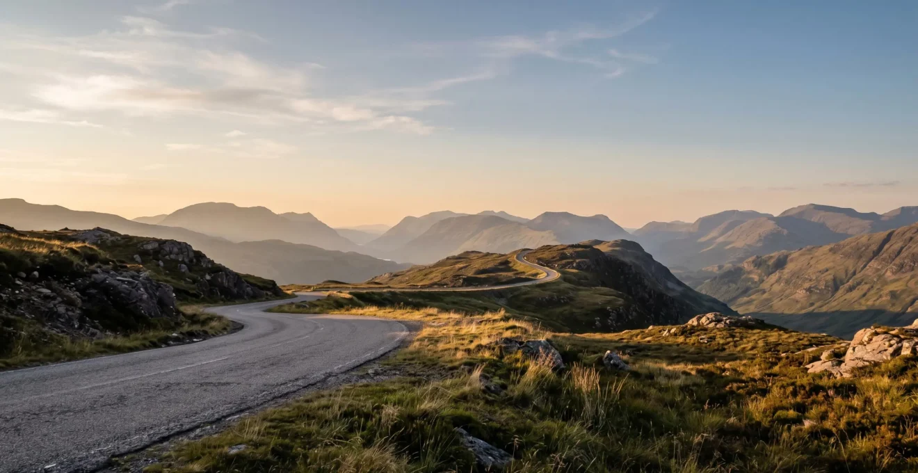
In summary:
- Superior panoramic views are found on elevated ridge-line roads, not in valleys, due to better light and unobstructed sightlines.
- Strategic timing involves using specific apps to plan for “blue hour” and sun trajectory, not just generic “golden hour.”
- Understanding practicalities like hyper-local parking rules and seasonal road closures is as crucial as knowing the destination.
- Coastal B-roads often provide more dramatic scenery per mile (“scenic density”) than major motorways or inland routes.
The quest for the perfect panoramic view is a familiar ritual for any driving enthusiast. It’s the feeling of rounding a bend and seeing the landscape unfold, a vast, breathtaking canvas that demands you pull over. Many of us rely on popular “top 10” lists, chasing famous names like Snowdonia or the Lake District, hoping to replicate a photograph we’ve seen online. Yet, the experience can often fall flat—the light isn’t right, the viewpoint is crowded, or the ‘accessible’ view requires a hike you weren’t prepared for.
The standard advice to “check the weather” and “go at sunset” is well-meaning but ultimately superficial. It treats the art of finding a stunning overlook as a matter of luck rather than strategy. But what if the key wasn’t simply knowing *where* to go, but understanding *why* certain locations deliver a superior visual payoff? What if you could learn to think like a viewpoint curator, equipped with the principles to find your own spectacular, uncrowded spots?
This guide moves beyond a simple list of destinations. It provides a strategic framework for discovering and experiencing the UK’s most dramatic roadside panoramas. We will deconstruct the science of high-ground advantage, delve into the art of precise timing for perfect light, navigate the common pitfalls that can ruin a trip, and ultimately reveal where to find the most rewarding views accessible directly from your car. It’s time to trade the map for a mindset.
To navigate this journey, this guide breaks down the essential strategies into distinct, actionable sections. Below is a summary of the key principles we will explore to transform your scenic drives from simple sightseeing into a masterclass in landscape appreciation.
Summary: Where to Find the UK’s Most Breathtaking Panoramic Overlooks by Road
- Why Ridge-Line Roads Offer Superior Panoramic Views Compared to Valley Routes
- How to Time Your Arrival for Golden-Hour Light at Panoramic Overlooks Using 3 Apps
- Snowdonia Viewpoints vs Lake District: Which Delivers More Dramatic Panoramas by Road?
- The Parking Mistake That Gets You Ticketed at Popular Viewpoint Lay-Bys
- When Viewpoints Become Inaccessible: Seasonal Road Closures in UK Uplands
- Why Coastal B-Roads Deliver Better Sunrise Shots Than Motorway Viewpoints
- Why Coastal Paths Offer 3× More Dramatic Scenery Per Mile Than Inland Trails
- Where to Find the UK’s Most Scenic Paths Accessible From Road Parking
Why Ridge-Line Roads Offer Superior Panoramic Views Compared to Valley Routes
The fundamental principle of finding a great panorama is simple: gain elevation. While valley roads can be charming, they inherently limit your perspective, boxing you in with steep sides. Ridge-line roads, by contrast, elevate you above the surrounding terrain, unlocking vast, uninterrupted sightlines. These high-altitude routes act as natural balconies, offering a commanding view that allows you to appreciate the scale and texture of the landscape below.
This isn’t just about seeing further. The quality of light is fundamentally different at elevation. As noted by Visit Wales in their description of Snowdonia’s routes, “Ridge-lines catch the ‘raking’ light of sunrise and sunset across their entire length, creating dramatic shadows and highlighting textures.” This low-angle light sculpts the land, revealing details and creating a sense of depth that is often lost in the flat, even light of a valley floor. Roads like the Horseshoe Pass in Wales, which reach heights of 1,368ft above sea level, are prime examples of this principle in action, transforming the drive itself into the main event.
Ultimately, a valley drive is an experience *within* the landscape, while a ridge-line drive is an experience *above* it. For the landscape enthusiast seeking that all-encompassing, breathtaking shot, the choice is clear. Prioritising roads that trace the high ground is the first and most important strategic decision you can make.
How to Time Your Arrival for Golden-Hour Light at Panoramic Overlooks Using 3 Apps
Every photographer knows about “golden hour,” but simply arriving an hour before sunset is a novice move. A curator’s approach to light requires a more nuanced strategy, using specific tools to predict not just the time, but the quality and direction of light. This is where modern apps become indispensable, transforming your smartphone into a sophisticated light-planning device. The goal is to anticipate how the sun will interact with your chosen landscape, ensuring you’re in the right place at the right time for the most dramatic effect.
As this image suggests, planning can begin long before the sun rises. True light strategy extends beyond the golden hour to include civil twilight and blue hour—the 30 minutes before sunrise or after sunset. This period often provides more moody, saturated colours and significantly fewer crowds. By leveraging a suite of specialised apps, you can master these subtle variations and guarantee spectacular results.
Your Pre-Viewpoint Arrival Checklist:
- Sun Trajectory: Use PhotoPills or The Photographer’s Ephemeris. Check the sun’s path with their augmented reality features to ensure your viewpoint’s orientation matches the event (e.g., don’t go to a west-facing overlook for sunrise).
- Optimal Light Window: Plan for blue hour and civil twilight. This 30-minute window before sunrise or after sunset offers dramatic, moody lighting and is often overlooked by others chasing the standard golden hour.
- Atmospheric Conditions: Use weather apps like ‘Windy’ or ‘Clear Outside’. These can predict cloud cover and haze. High-level clouds are your friend, creating spectacular light shows, while low fog in valleys can lead to breathtaking inversions when viewed from a ridge-line.
- Parking Reconnaissance: Use Google Maps’ satellite and Street View to scout the designated lay-bys. Check for size, restrictions, and potential overflow areas. Arrive early to secure a safe, legal spot.
- Route & Closure Check: Before setting off, check local council or National Park websites for any seasonal road closures or reported issues, especially for high-altitude passes in autumn and winter.
Snowdonia Viewpoints vs Lake District: Which Delivers More Dramatic Panoramas by Road?
When it comes to epic UK landscapes, two titans immediately spring to mind: Snowdonia and the Lake District. Both offer world-class scenery, but they provide distinctly different types of topographical drama from the roadside. Choosing between them depends entirely on the kind of panoramic experience you’re seeking. Snowdonia offers raw, jagged, and often more challenging routes, while the Lake District presents a more lyrical, layered beauty with greater water-based compositions.
The geological character is the key differentiator. Snowdonia’s volcanic rock and slate peaks create a sense of stark, imposing drama. The drives feel wilder, with single-track roads like the Llanberis Pass carving through a landscape that feels ancient and untamed. The Lake District, with its rolling fells and numerous reflective bodies of water, offers a softer, more romantic drama. The presence of lakes and tarns visible from the roadside provides endless opportunities for compositions featuring reflections and leading lines, an element rarer in Snowdonia’s high passes.
While Snowdonia may feel more intensely dramatic, the Lake District wins on sheer popularity and a different kind of accessibility. According to research by Vanarama, it’s the undisputed champion in online interest, with their team noting, “The Lake District tops our list for the best driving roads in the UK with a total of 37,200 yearly searches on YouTube.” This popularity is partly due to its more accessible main passes, like Honister and Kirkstone, which are generally wider and less intimidating than Snowdonia’s Bwlch y Groes.
| Criterion | Snowdonia | Lake District |
|---|---|---|
| Annual YouTube Searches | 25,000+ | 37,200 |
| Park Size | 823 square miles | 912 square miles |
| Geological Character | Raw & Jagged Drama (volcanic rock, slate peaks) | Lyrical & Layered Drama (rolling fells, reflective water) |
| Road Accessibility | More technically challenging single-track roads (Llanberis, Bwlch y Groes) | More accessible main passes (Honister, Kirkstone) |
| Water Features from Road | Rarer roadside water compositional elements | Numerous lakes and tarns visible from roadside (reflections, leading lines) |
| Elevation Description | Mount Snowdon tops 1,085m | Hardknott Pass—one of England’s steepest roads |
The Parking Mistake That Gets You Ticketed at Popular Viewpoint Lay-Bys
You’ve timed your arrival perfectly, the light is magical, and the view is breathtaking. But the small, designated lay-by is full. The critical mistake many drivers make is to improvise, pulling onto a soft verge, a passing place, or a spot that partially obstructs the road. This isn’t just a minor inconvenience; it’s a costly error that can attract significant penalties. In the UK’s national parks and on designated scenic routes, improper parking is taken seriously, with Penalty Charge Notices ranging from £70 to £130.
The problem is particularly acute on popular routes that have seen a surge in traffic. The North Coast 500 in Scotland has become a prime example of this issue. Authorities have repeatedly warned drivers against stopping in unofficial turnouts on blind corners or soft verges, which poses a safety hazard to other road users. This is not about revenue generation; it’s about managing traffic flow and safety on roads that were often not designed for high volumes of tourist traffic stopping intermittently.
The NC500 ‘False Summit’ Parking Problem
The North Coast 500 route has become a case study for the increasing problem of unofficial turnout parking. Drivers stopping in unauthorized spots on blind corners or soft verges face both safety hazards and potential fines. Scottish authorities have emphasized checking for road closures and safe driving conditions ahead of time, with winter bringing particular enforcement challenges around unofficial parking areas that seem safe but are extremely dangerous.
The only solution is access-awareness and planning. Before you even start your engine, use tools like Google Street View to assess the parking situation at your target viewpoint. If it looks limited, have a backup plan. Arrive earlier than you think you need to, especially at sunrise or sunset. The golden rule is simple: if it’s not a clearly marked, hard-surfaced lay-by, it’s not a parking spot. The perfect photo is never worth a fine or, worse, causing an accident.
When Viewpoints Become Inaccessible: Seasonal Road Closures in UK Uplands
Many of the UK’s most dramatic roadside panoramas are located on high mountain passes, which are also the most vulnerable to seasonal weather conditions. It’s a frustrating reality for landscape enthusiasts: the very conditions that can create the most atmospheric photos—snow, ice, and fog—are also the ones that can make the route impassable. Assuming a road will be open simply because it’s a designated scenic route is a common and trip-ruining mistake, especially from late autumn to early spring.
As The Trade Centre UK wisely advises, “During the colder seasons, also check for road closures ahead of time and safe driving conditions.” UK authorities often use permanent gate systems on the most challenging passes. These gates are not suggestions; they are closed when the road is deemed unsafe, and attempting to bypass them is illegal and extremely dangerous.
Bealach na Bà Winter Gate System
Bealach na Bà, ‘Pass of the Cattle’ in Scottish Gaelic, exemplifies the UK’s permanent winter gate system for high mountain passes. Hailed as one of the toughest scenic driving routes in the UK, it features winding bends, steep inclines and narrow roads as one of the highest roads in Scotland. The pass employs permanent winter gates that close during adverse conditions, requiring drivers to have pre-planned alternative routes through lower-altitude drives.
The key takeaway is to build flexibility into your plans. Before setting out, always check the local council’s website or the relevant National Park authority’s social media feeds for real-time updates on road conditions. Have a lower-altitude alternative route planned. This proactive approach not only ensures your safety but also saves you the disappointment of a long drive to a closed gate. The mountains will still be there tomorrow, but only if you can get to them safely.
Why Coastal B-Roads Deliver Better Sunrise Shots Than Motorway Viewpoints
Motorway service stations occasionally boast a ‘viewpoint’, but these are rarely the locations for breathtaking photography. They are often compromised by infrastructure, light pollution, and a lack of compositional interest. For a truly epic sunrise, the discerning driver should look to the UK’s vast network of coastal B-roads. With a coastline that stretches nearly 12,500 km, there is an almost endless supply of opportunities for spectacular morning light.
Coastal B-roads offer several distinct advantages. Firstly, they provide an unobstructed eastern horizon over the sea, which is essential for capturing the first rays of dawn. Secondly, they offer far more dynamic and varied perspectives. Unlike the straight, unchanging line of a motorway, these smaller roads weave and wind, climbing headlands and dipping into coves. This “topographical rollercoaster” effect means you can find countless unique pull-offs and lay-bys that offer different angles on the same sunrise. You have the flexibility to compose your shot with foreground interest like cliffs, sea stacks, or harbour walls.
The Atlantic Highway (A39) in the South West is a perfect illustration of this principle. As Uncover Britain highlights, “The A39 dips in and out of dramatic clifftop scenery, giving you panoramic glimpses of the Atlantic while also offering access to beaches, surf spots, and historic harbours.” It’s this constant variety, this high scenic density, that makes coastal B-roads so rewarding. You aren’t just driving to a single viewpoint; the entire journey is a series of potential masterpieces waiting to be discovered.
Why Coastal Paths Offer 3× More Dramatic Scenery Per Mile Than Inland Trails
The concept of “scenic density” is what sets coastal routes apart. While a walk in the country can be beautiful, the view often remains consistent for long stretches. A coastal path, however, is a study in constant, dramatic change. The “3x” is a qualitative measure, not a scientific one, but it captures a fundamental truth: for every mile you travel along the coast, the landscape transforms more frequently and more dramatically than on most inland trails.
This heightened drama comes from the unique interplay of geology, water, and elevation. A coastal route is a “topographical rollercoaster,” constantly climbing to a windswept headland for a vast, panoramic view, then descending towards a secluded cove where the perspective becomes intimate and enclosed. The ever-present sea provides a dynamic backdrop—crashing waves, changing tides, and the shifting colours of the water itself. This combination of land and sea creates a continuous sequence of “wow” moments that is hard to match inland.
The Atlantic Highway Scenic Density
The Atlantic Highway, weaving along Cornwall’s rugged north coast, demonstrates the ‘architectural and geological density’ principle of coastal routes. The A39 continuously dips in and out of dramatic clifftop scenery, packing multiple ‘wow’ moments per mile: sea stacks, historic harbours, surf spots, and panoramic Atlantic glimpses. Viewpoints between Bude and Tintagel provide optimal coastal photo opportunities, with the route offering a constant ‘topographical rollercoaster’ effect as it climbs headlands and descends to coves.
This principle of high scenic density means your effort is rewarded more quickly and more often. You don’t need to commit to a gruelling multi-hour hike to feel like you’ve experienced a variety of stunning landscapes. A short walk from a roadside car park can often yield a wealth of different compositions and vistas, making coastal paths the most efficient way to experience the UK’s dramatic beauty.
Key Takeaways
- Seek Elevation: Prioritise ridge-line roads over valley routes for superior light and unobstructed panoramic views.
- Master the Light: Move beyond “golden hour.” Use specialised apps to plan for sun trajectory and the more dramatic light of “blue hour” and civil twilight.
- Plan for Practicalities: Avoid costly fines and disappointment by researching hyper-local parking rules and checking for seasonal road closures on high-altitude passes before you go.
Where to Find the UK’s Most Scenic Paths Accessible From Road Parking
The ultimate goal for a viewpoint curator is to find locations that offer the maximum scenic reward for a reasonable amount of effort. While multi-day treks have their place, the real gems are often the stunning panoramas accessible via a short walk from a designated road parking area. These spots provide the perfect blend of accessibility and wild beauty, making them ideal for sunset chasing or a quick photographic expedition. The UK is dotted with such locations, particularly in its popular national parks which attract huge numbers of visitors, like the Peak District with around 13 million visitors every year.
An effective way to evaluate these opportunities is to use an Effort-to-Reward Matrix. This mental model helps you weigh the difficulty of the drive and the length of the walk against the quality of the view. A “High Reward, Low Effort” location like Devil’s Dyke offers world-class views just steps from the car park. A “High Reward, High Effort” location like Scafell Pike requires a serious mountain ascent but delivers an unparalleled panorama. The sweet spot for many is the “High Reward, Medium Effort” category, like the drive to the top of Bealach na Bà followed by a short walk.
The following table provides a curated selection of scenic paths across the UK, categorised by this matrix. It serves as a starting point for your own explorations, providing a blueprint for how to assess potential viewpoints based on their accessibility and visual payoff.
| Location | Effort Level | Reward Level | Parking Details | Path Type |
|---|---|---|---|---|
| Old Man of Storr (Isle of Skye) | Low (1-mile walk) | High | Designated car park in Portree—arrive early | Linear to viewpoint |
| Hardknott Pass (Lake District) | Medium | High | Start in Ambleside via A593/B5289 | Circular options available |
| Devil’s Dyke (South Downs) | Low | High | South on A27 from Brighton | South Downs Way access—circular |
| Broadway Tower (Cotswolds) | Low | Medium-High | A44 from Evesham, then B4632 | Short walk from parking |
| Scafell Pike from Wasdale Head | High | High | Wasdale Head car park—limited spaces | Linear mountain ascent |
| Bealach na Bà (Scottish Highlands) | Medium (drive + short walk) | High | Village of Tornapress (A896)—stop at top | Road-accessible vista point |
Now that you are equipped with the curator’s framework—the principles of elevation, light strategy, and access-awareness—the UK’s road network becomes your gallery. The next step is to choose a destination, put these principles into practice, and start discovering your own breathtaking panoramas. Start planning your next scenic adventure today.